Earlier this month, a cohort of Milano students as well as interested students from across The New School contributed to humanitarian efforts in a rapidly expanding district on the outskirts of Port-au-Prince known as Canaan. Following the 2010 Haiti earthquake, many families were displaced to this district which unfortunately features very informal, haphazard and failing infrastructure. Further, the Haitian government does not recognize Canaan as a permanent settlement and thus exempts it from infrastructure services provided by the government.
The Haitian Red Cross sees this district as an increasing risk to its inhabitants and is developing emergency preparation plans and health facilities to especially benefit its most vulnerable populations. A critical component of this effort is the immediate need for base maps and logistical mapping for this informal, expanding district… and this is where The New School’s mapping project met local humanitarian efforts.

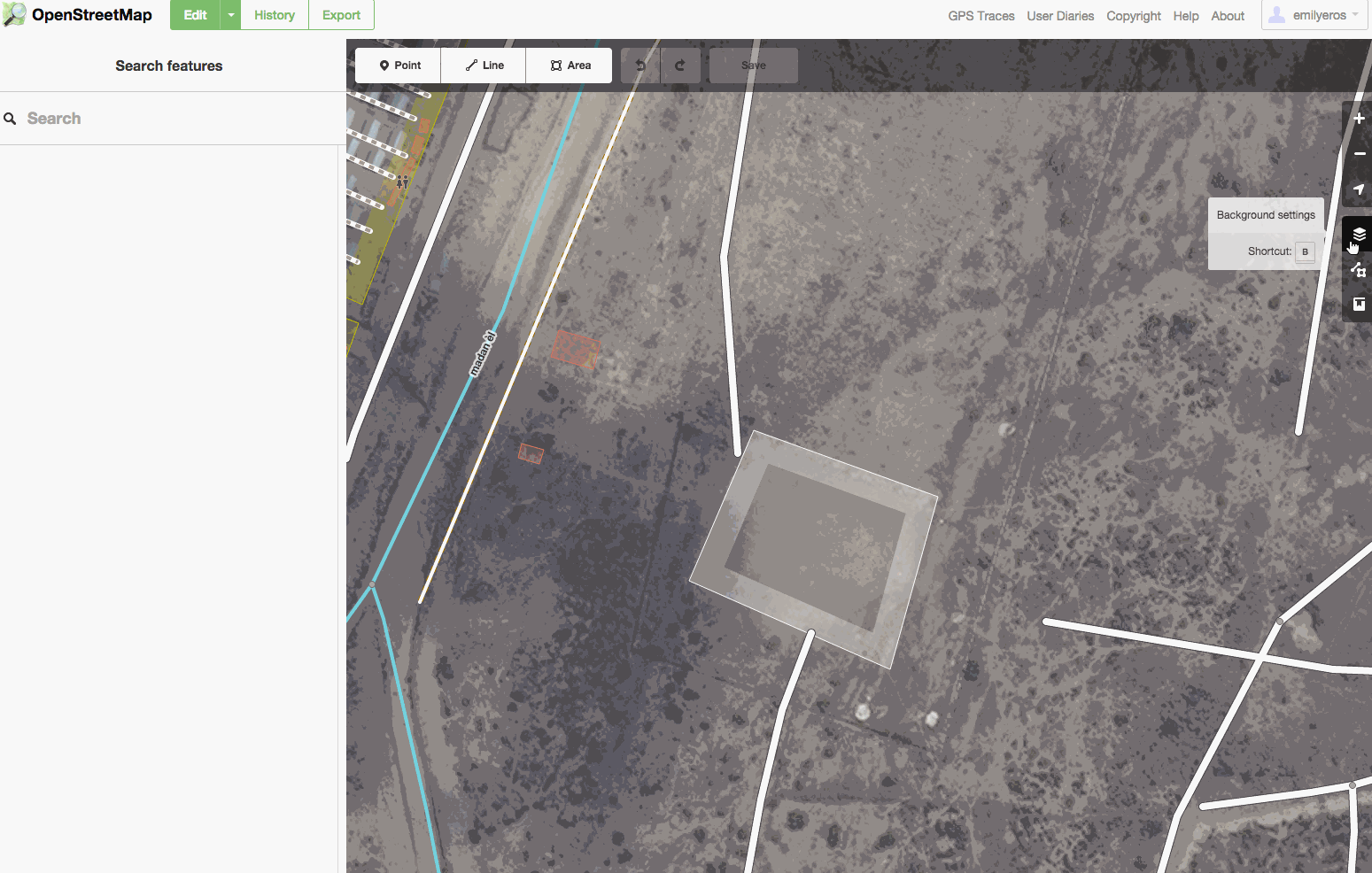
With guidance from Milano part-time faculty members Eric Brelsford and Stephen Metts- both of whom teach GIS and spatial technology classes within Milano’s programs- participating students utilized OpenStreetMap’s (OSM) new, innovative ID Editor in conjunction with the humanitarian arm of OSM known as Humanitarian OpenStreetMap Team (HOT) to ascertain and develop map features throughout Canaan. The mapping task itself is part of the new Missing Maps Project, a corollary of HOT whose focus is very specific mapping tasks in conjunction with local communities such as the Haitian Red Cross initiative in Canaan. Late last year at the International Conference of Crisis Mappers held at The New School, then director of HOT, Kate Chapman, introduced the new Missing Maps Platform:
Mapping with HOT and Missing Maps in OSM involves a unique tasking process wherein a contributor “locks” a square area in order to map roads, pathways, buildings, and land use, according to the requests of HOT and its partner organizations. For the Canaan task, the highest priority is buildings in various states of construction, road networks (from highways to footpaths), and walls and fences. This process and much of the software is exactly the same as is used in crisis situations such as the ongoing response to the recent earthquake in Nepal.
During the mapping project, students used the Canaan Edit Guide to assist in capture and classification techniques best suited to the task. The Haitian Red Cross will use these new features as they take effect in OSM for emergency planning and logistical support.

Another cutting-edge technology that is being employed through HOT mapping in OSM is the utilization of UAV ‘drone’ imagery. This extremely high-res imagery is particularly useful in capturing and classifying ‘under construction’ buildings that can easily escape detection in less refined satellite imagery. Unfortunately, during the mapping project at The New School there was a problem serving the imagery and thus participants found tasks involving building classification to be somewhat complicated.
Mapping efforts such as this project for Canaan fall into the theoretical framework developed largely by Michael Goodchild in the mid-2000’s wherein he deemed voluntary mapping efforts as ‘Volunteered Geographic Information’ (VGI). More recently, Patrick Meier, a founder of Crisis Mappers and recent author of Digital Humanitarians- How BIG DATA is Changing the Face of Humanitarian Response discusses the deployment of platforms like OSM for humanitarian efforts with newer terms such as ‘Microtasking’, ‘MicroMappers’ and ‘Humanitarian UAV’s’.
In all, the innovations that are taking place in online mapping platforms and the efforts of mappers and mapping projects worldwide for humanitarian efforts with local communities is nothing short of inspiring. For students who are interested in these emerging technologies, two good options to explore would be to, one, enroll in a Fall or Spring 2015/16 GIS section offered by Milano; and/or attend the upcoming OpenStreetMap ‘State of the Map US 2015’ conference that is being held this year at the United Nations, June 6th-8th. For more information on both options, Eric can be contacted at [email protected]; Stephen at [email protected].